
QNH twelve hundred, low ceiling, an RNP APCH with an LNAV/VNAV line: the crew descends toward the final approach fix, the vertical deviation is centred, the displayed angle matches the chart, the descent is stable. The standard setting stayed in both windows. The aircraft crosses every step roughly three hundred feet lower than what the chart protects, and nothing shows it: the altitude comparator sees two altimeters agreeing, the altitude alert sees the selected altitude reached, the vertical guidance follows without error the plan it was asked to build. An erroneous altimeter setting does not degrade barometric guidance, it shifts its reference, and there is then nothing left to display.
What a setting shifts, exactly
A barometric altimeter knows only a static pressure and a fixed conversion law, that of the standard atmosphere. The setting touches neither the sensor nor the law: it fixes the origin of the scale, the pressure at which the instrument must display zero. Increasing the value dialled into the window raises the indication, by roughly twenty-seven feet per hectopascal near sea level, more at altitude, where a hectopascal spans a thicker slice of air.
From this comes the property that carries the whole subject: the error introduced by a wrong setting is an origin offset, hence a constant. It does not depend on height, does not vary along the descent, does not dilute as the ground is approached. The entire vertical structure of the procedure translates as a block: intermediate steps, the altitude at which the final approach fix is crossed, the final path itself, the decision altitude or minimum descent altitude, the level-off altitude of the missed approach. Nothing deforms, everything shifts by the same number of feet.
The direction follows without a mnemonic. A setting higher than the real QNH places the origin of the scale too low in the air column: the instrument over-reads, the indicated altitude exceeds the true altitude, and a crew flying to indicated altitudes reaches each of its targets while physically below it. A lower setting produces the exact opposite: under-reading, aircraft too high. The asymmetry is not neutral: the dangerous direction is that of the too-high setting, and that is exactly what results from keeping the standard setting on a low-pressure day — precisely a day on which the approach is actually flown.
A wrong altimeter setting shifts all altitudes up or down by the same amount. If the setting is too high, the plane thinks it’s higher than it really is, so it flies lower than the chart says. If the setting is too low, the opposite happens. The system doesn’t notice because it only compares itself to itself, not to reality.
On a low-pressure day, a crew keeps the standard setting (1013 hPa) while the real QNH is 990 hPa. The aircraft crosses the final approach fix at 1,000 feet indicated, but in reality, it’s 300 feet lower (since 1013 – 990 = 23 hPa, and 23 × 27 ≈ 621 feet). The plane thinks it’s at 1,000 feet, but it’s actually at 379 feet, risking collision with obstacles.
Why the guidance loop has nothing to report
The computer reconstructs the final segment as a geometric object: an angle anchored on the threshold and on a reference crossing height. But it does not fly it geometrically. It expresses it in barometric altitudes, from the same air-data inputs that feed the display, then commands the aircraft to cancel the gap between measured altitude and target altitude.
Both terms of that gap carry the same offset, and the subtraction removes it. The vertical deviation shown to the crew is therefore rigorously exact with respect to the reference used, and rigorously silent on the validity of that reference. The one indicator that could warn is, by construction, centred. The error is not absorbed by the system: it is carried entirely into the physical world, where no sensor in the guidance loop looks at it.
What an altitude comparator can see, and what it will never see
Onboard altitude monitoring is differential: it compares sources against each other and flags their divergence. A wrong setting applied identically on both sides creates no divergence whatsoever. It is a common-mode error, invisible to a device that can only measure gaps between channels. The standby altimeter, where it has its own setting window, would only provide a cross-check if it carried a value obtained independently; practice is to align it on the other two, which closes the very door it opened. The same logic applies to the altitude alert, which compares barometric altitude to selected altitude, two quantities equally offset. The same logic applies to the readback, where the crew reads back an indicated altitude that is perfectly consistent with the clearance received.
Constant offset or distorted slope: two families not to be confused
Temperature error also brings the aircraft below the published path, and also leaves the vertical deviation centred. Confusing the two is common in briefings, even though their signatures share nothing. Temperature error is zero at the level of the setting source and grows with height above that source: small near the threshold, large at the final approach fix, it actually lowers the angle flown. The setting error, constant, does not alter the angle by a hundredth of a degree but remains as large at the threshold as at the fix.
| Criterion | Setting error | Temperature error |
|---|---|---|
| Nature of the offset | Shift of the scale origin | Conversion error of the standard law |
| Distribution with height | Constant | Increasing above the setting source |
| Effect on the angle flown | None | Angle lowered below the published angle |
| Offset at threshold crossing | Full offset | Near zero |
| Effect on the decision point | Reached lower, or higher, by the full offset | Reached near the published height |
| Predictable before the flight | No: depends on a crew action | Yes: temperature known, correction available |
| Place in the design vertical budget | Outside the budget | Within the budget, between the promulgated limits |
| Detection by the radio altimeter on final | Possible over known regular terrain | No: offset too small down low |
Two consequences follow. Temperature error is largest where the obstacle margin is most comfortable and smallest where it is tightest; setting error ignores that leniency and consumes the margin of the last mile just as surely as that of the intermediate segment. And this is what underlies the most useful cross-check on approach: a radio altimeter sees a wrong setting near the threshold, whereas it barely sees a temperature error there at all.
The mix-ups that all produce the same symptom
The symptom is unique: a flight stabilised and consistent with the indications, yet offset in space. The causes, though, are distinct, and so is their direction: sorting them by direction serves better than sorting them by name.
| Mix-up | Altimeter reading | Actual position relative to the published path |
|---|---|---|
| Value higher than the real QNH: transposed digits, value from another station | Over-reading | Below the path |
| Value lower than the real QNH | Under-reading | Above the path |
| Standard setting kept, QNH below the standard atmosphere | Over-reading | Below the path |
| Standard setting kept, QNH above the standard atmosphere | Under-reading | Above the path |
| Stale QNH in a rapidly falling pressure field | Worsening over-reading | Below the path, growing offset |
| QFE set while the procedure publishes altitudes | Under-reading by the full field elevation | Far above the path |
| QNH set while the procedure publishes heights | Over-reading by the full field elevation | Far below the path |
| Pressure unit mismatch between the source and the window | Gross offset, either direction | Depends on the value retained |
Two time windows concentrate the risk. The setting change at the transition level falls in an already loaded phase: level change, speed reduction, frequency change, sometimes a tactical heading. A linguistic cue exists, the clearance shifting from flight level to altitude, but it is a weak cue when the altitude is delivered in the same sentence as a heading. The other window is the source of the value: a QNH heard once, on a single channel, then written down by both pilots. The redundancy is apparent — both windows carry the same transcription. Data link removes the mishearing risk but introduces that of staleness, and an old value in a moving pressure field is a wrong value that looks right.
The trap. Dual setting is not a cross-check. Two pilots who write down the same value from the same hearing only verify their mutual agreement, and in doing so manufacture the very common-mode error that onboard monitoring is unable to see. Announcing the value read in the opposite window closes the loop for good: it confirms the copy, not the source.
What a wrong setting shifts, depending on the vertical guidance
The idea that satellite guidance would shelter against a setting error circulates, and it is true of only a third of the problem. Three objects must be kept separate: the path flown, the point at which one decides, and the step altitudes that bracket the whole.
| Vertical guidance | Path flown | Decision point | What remains exposed |
|---|---|---|---|
| Barometric guidance, LNAV/VNAV line | Shifted by the full offset | Shifted by the full offset | The entire profile, from the intermediate step to the missed approach |
| Satellite augmentation, LPV line | Intact, geometric reference | Shifted: the decision altitude remains barometric | The decision and the step altitudes |
| Ground-based augmentation | Intact, ground reference | Shifted, same reason | The decision and the step altitudes |
| Radio glide path, minima in altitude | Intact, beam | Shifted | The decision and the step altitudes |
| Radio altimeter decision height minima | Intact | Intact, ground reference | The step altitudes and the missed approach |
| LNAV line flown on an advisory vertical profile | Shifted | Shifted: the minimum descent altitude is barometric | The whole profile, with no certified guidance to flag it |
A geometric descent path shields the path flown, never the decision, and never the step altitudes. The shortcut according to which the setting would matter less under satellite guidance is therefore wrong exactly where it costs the most, at the very last point where the approach can still be discontinued.
What the design vertical budget has never covered
The obstacle clearance height of a barometric line was established with a vertical error budget: air-data system error, temperature effect between the promulgated limits, flight technical error. All of these terms assume a correct local QNH. A gross setting error is not one more term in that budget, it is its full consumption, plus whatever exceeds it. And since the decision point shifts by the same offset, the crew reaching the indicated decision altitude believes it holds the published height above the touchdown zone when it in fact has less. Visual acquisition occurs lower and later: an approach that would otherwise have been discontinued becomes an attempt carried out from a position no one sized for.
The cross-checks that catch the error
The most robust link is the ground altimeter check, before taxi: QNH set, indicated altitude compared against the known altitude of the parking position, within the tolerance fixed by approved documentation, on the order of a few tens of feet. It is the only check that confronts the entire chain, source included, with a known, exact truth. It says nothing about the arrival QNH, but it validates the instrument and anchors the habit of comparing.
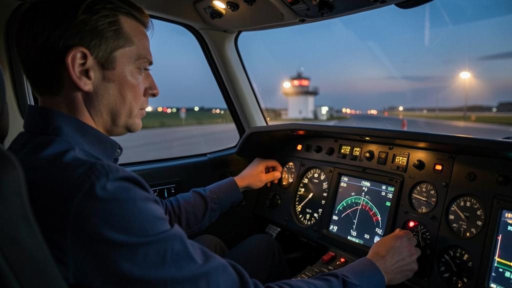
Next comes the plausibility of the value, before it is even set: deviation from the standard atmosphere, consistency with the transition level in force, comparison with the previous message and the announced trend. A transposed digit rarely produces a plausible value within a series. Then comes the independence of the source: the monitoring pilot announces the value read from the source, not the one read in the opposite window.
What the ground sees that the cabin does not
The transponder reports a pressure altitude referenced to the standard setting: it never passes through the crew’s setting window. Below the transition level, the ground system itself applies the QNH to display an altitude to the controller. There is therefore a view of the aircraft’s actual level structurally independent of any error made on board, and it is on this view that ground minimum safe altitude warnings operate. A query from control about altitude is never a formality: it is one of the very few external signals capable of pointing to a wrong setting, and it deserves a check of the setting before the reply. Some ground infrastructure additionally uses the setting selected on board when it is available over the surveillance data link. What no readback will ever catch, however, is a crew reading back an indicated altitude that is consistent with the clearance.
What remains is the radio altimeter checked against the published height. The chart gives an altitude and a height whose difference is a terrain elevation; over regular, known terrain, a substantial disagreement on reaching minima points to the setting. It still requires having established at briefing that the terrain allows it: over uneven terrain or a displaced threshold, the comparison is worth nothing. GNSS-derived geometric altitude, where presented, is insensitive to the setting, but it is referenced to an ellipsoid rather than mean sea level, its vertical component is the least well determined part of the navigation solution, and it holds no approved altimetry-reference status: it catches a unit mix-up or a QFE inversion, not a few hectopascals.
The right reflex. Announce the value read from the source, never the one shown in the opposite window, and make descent below the transition level conditional on a value whose plausibility has been tested: deviation from the standard atmosphere, trend, message timestamp. Then decide at briefing, not on final, whether comparing radio height to published height is usable on this approach.
What to settle in one’s own documentation
A few points are worth deciding before they are needed. Which tolerance applies to the ground altimeter check, and against which altitude: that of the parking position or that of the aerodrome reference point, which differ on sloping terrain? Does the operator’s policy allow barometric guidance on a regional or distant QNH, and beyond what age does a value cease to be usable? Does the setting call-out phraseology name the source, or only the value? Is the comparison between radio height and published height at minima a formalised gate, or an individual habit that will disappear with whoever practises it? And what does the procedure require when control queries the altitude: check then answer, or answer then check?
Three grey areas remain. The aerodrome whose QNH is not measured on site continues to be handled unevenly from one operator to another, even though the offset there is structural rather than accidental. The intermediate segment absorbs the full offset without any chart note drawing attention to it, unlike the final segment. The mixed-unit environment, finally, is not settled by a note but by a display design over which the crew has no control. For anyone preparing a type rating or a performance-based navigation training module, the question asked never concerns hectopascal arithmetic: it concerns the direction of the offset, and the fact that a barometric decision altitude remains barometric under a geometric descent path.
This article describes a mechanism and the cross-checks commonly used to contain it; it constitutes neither a procedure, nor an authorisation, nor an approved method. In case of divergence, the applicable text, the charts in force, and the operator’s approved documentation prevail over what is written here.
Questions fréquentes
Does a setting higher than the real QNH make the aircraft fly too high or too low?
Too low. A setting value higher than the real value places the origin of the scale too low in the air column, so the altimeter over-reads: the indicated altitude exceeds the true altitude. A crew descending to an indicated altitude then finds itself physically below that altitude, by the full offset introduced. This is the dangerous direction, and it is exactly what results from keeping the standard setting on a low-pressure day.
Why does the altitude comparator not detect a wrong setting?
Because it is differential: it compares altitude sources against each other and flags their divergence. A wrong setting entered identically on both sides creates no divergence — it is a common-mode error. The standby altimeter changes nothing once it is aligned on the same value, and the altitude alert compares two quantities affected by the same offset.
Does a setting error change the angle of the final path?
No. It shifts the origin of the altitude scale, so it translates the entire profile as a block without distorting its slope. This is what distinguishes it from a temperature error, which grows with height above the setting source and does actually lower the angle flown. Practical consequence: a setting error is as large at the threshold as at the final approach fix, whereas a temperature error is nearly zero there.
Does satellite guidance protect against a setting error?
It protects the path flown, not the decision. A descent path derived from satellite augmentation or ground-based augmentation is geometric and remains insensitive to the setting. But the published decision altitude is a barometric altitude, like the intermediate step altitudes: they all shift by the offset introduced. Relaxing vigilance on the setting because a geometric guidance is being followed therefore fails precisely at the last point where the approach can still be discontinued.
Can air traffic control see a setting error made on board?
Yes, indirectly, and it is one of the few external signals available. The transponder reports a pressure altitude referenced to the standard setting, which never passes through the crew’s setting window; the ground system itself applies the QNH to display an altitude. The controller therefore has a view of the actual level independent of the error, and ground minimum safe altitude warnings operate on this view. A query from control about altitude therefore deserves a check of the setting before any reply.
What is the point of the ground altimeter check if the arrival QNH will be different anyway?
It is the only check that confronts the entire chain, from source to instrument via the transcription, with a known, exact truth: the altitude of the parking position. It obviously does not validate the setting that will be used on arrival, but it detects instrument drift and transcription error, and it establishes the habit of comparing that will be used on approach. The applicable tolerance and the reference altitude to use are given in the operator’s approved documentation.


Leave a Reply
You must be logged in to post a comment.