
Descending toward an aerodrome in severe cold: the altimeter reads 3,000 ft on the current setting, while the position page shows a geometric height several hundred feet lower. Nothing is malfunctioning, and the question of “which of the two is right” has no answer: the two numbers do not describe the same thing. What remains is to know which one keeps you from meeting the other aircraft — and why it is the less precise of the two.
Two Quantities That Do Not Measure the Same Thing
A barometric altimeter is a pressure gauge. It measures the static pressure sensed by the static ports and displays it in feet by means of a fixed conversion, that of the International Standard Atmosphere, ISA: 1,013.25 hPa and 15 °C at sea level, followed by a gradient of 6.5 °C per kilometre up to the standard tropopause. The dial therefore has no knowledge of height: it knows a pressure, and derives an altitude from it under the assumption of an atmosphere that almost never exists. The setting knob does not correct this assumption in any way — it merely shifts the origin of the scale, by roughly 27 feet per hectopascal near sea level. Depending on the value set, the same pressure translates into altitude above sea level, height above a terrain reference, or pressure altitude — the flight level.
Le GNSS works differently: it resolves a position within a geocentric reference frame, then expresses the vertical component as a distance to a mathematical surface, the ellipsoid of the World Geodetic System. This surface is not sea level. The geoid, an equipotential surface that approximates mean sea level, departs from it by several tens of metres almost everywhere, and by roughly a hundred metres in the most pronounced regions. Receivers therefore embed a geoid model to restore a height “above sea level”, and this model has its own residual error: two pieces of equipment from different generations can display two distinct heights without either being at fault.
On one side, the position on an isobaric surface, translated into feet by an atmospheric model; on the other, a geometric distance to a conventional surface. There is no single true number of which the two instruments would give unequal approximations.
The altimeter shows pressure as altitude, while GNSS shows actual distance from the Earth’s surface. They measure different things, so they can’t be directly compared. One is used for separation, the other isn’t.
| Reference | Quantity measured | Origin surface | What causes it to drift | Role in separation |
|---|---|---|---|---|
| Pressure altitude, standard setting | Static pressure converted via the ISA model | 1,013.25 hPa isobar | Static port, instrument error, flying technique deviation | Sole reference above the transition altitude |
| Altitude on regional or aerodrome setting | Same measurement, shifted origin | Isobar of the setting displayed | Same as above, plus how recent the setting is | Separation and obstacle clearance below the transition |
| GNSS geometric height | Distance to a reference surface | Geodetic ellipsoid, or modelled geoid | Satellite geometry, augmentation, geoid model, jamming | None: neither reported nor used by the anti-collision system |
| Radio altimeter height | Distance to the ground overflown | The terrain, beneath the aircraft | Nature and slope of the terrain, attitude, structures | None: a local measurement, not shareable |
Separation Does Not Require Accuracy, but a Common Error
Stacking two aircraft at FL340 and FL350 is not a problem of absolute measurement, it is a problem of order. These two levels designate two distinct isobaric surfaces, which rise, fall, tilt and draw closer together according to the thermal structure of the air mass, but never cross. Whatever the deformation, the one above stays above.
That is the whole mechanism. The altimetry error attributable to the real atmosphere is considerable in absolute terms, and it is nearly identical for both aircraft: it cancels out in the difference, which is the only quantity that matters. What remains is the error specific to each measurement chain: static port defect, instrument error, level-keeping deviation. Three small, bounded, certified and verifiable factors — and it is on these that the separation minimum rests.
Two A320s flying at FL340 and FL350 in an air mass 10°C colder than ISA. The altimeters show 1,000 ft difference, but the actual vertical separation is only 960 ft. However, both aircraft experience the same error, so the order is preserved.
Substituting a geometric height would destroy this property. GNSS is more accurate in absolute terms, but its errors are not common: they depend on the constellation seen by each receiver, the augmentation available, the geoid model applied, the fallback configuration in use. One would be trading a large shared error, which costs nothing, for small individual errors, which cost exactly where it matters. Barometric measurement, by contrast, is self-contained: on the standard setting, it depends on no external signal and no infrastructure liable to be lost in flight.
The second argument is one of interoperability. The entire surveillance chain speaks pressure altitude: the transponder reports it, level-deviation monitoring compares it to the clearance, the minimum altitude alert relies on it, and the airborne anti-collision system coordinates its manoeuvres in that unit. Two aircraft negotiating a vertical resolution must share a convention, not a truth. The aircraft itself, moreover, lives in pressure altitude: flight envelope, buffet limits, certified engine ratings and Mach-to-true-airspeed conversion all depend on it.
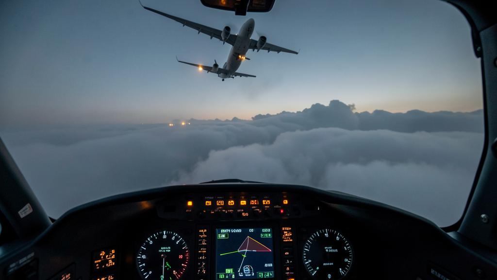
Where the Deviation from ISA Makes the Two Readings Diverge
In an air mass colder than the standard atmosphere, the air is denser, pressure decreases faster with altitude, and the isobaric surface labelled FL350 lies geometrically lower than its name suggests. The order of magnitude used by practitioners is about 4 feet per thousand feet indicated per degree of deviation from ISA: an approximation, but one that frames the consequences.
In cruise, this deviation does not affect separation, since it is common to both aircraft. It does affect obstacle clearance, as soon as the vertical reference of the profile is barometric: the altimeter reads more than the true height, the margin shrinks, and it is this reasoning that underlies the temperature corrections applied to minimum sector altitudes and approach step-downs. It also affects geometric spacing: in a distinctly cold air mass, a thousand feet of pressure difference no longer equals a thousand feet of distance, but several tens of feet less. A bounded deviation, absorbed by the design of the minimum — but no longer bounded if a setting error is added to it.
| Situation | What the altimeter shows | Actual position | Practical consequence |
|---|---|---|---|
| Air mass colder than ISA | More than the true height | Lower than indicated | Reduced clearance margin: correction to be applied |
| Air mass warmer than ISA | Less than the true height | Higher than indicated | Increased margin, offset descent profiles |
| Flight toward lower pressure, setting not updated | More than the true height | Lower than indicated | The outdated setting: the error is no longer shared |
| Blocked static port, or standby source | Non-representative value | Indeterminate without cross-checking | The error ceases to be common: this must be reported, it cannot be made up with GNSS |
Altitude-Keeping Monitoring Reverses the Reasoning
Reduced vertical separation minimum — RVSM — brings spacing down to a thousand feet within designated airspace, typically between FL290 and FL410. This gain does not come from a more accurate instrument, but from a controlled and monitored vertical error budget: the total deviation breaks down into an error specific to the altimetry system and a deviation from the assigned level. The first term is a matter of certification, static-port installation and maintenance; the second, of piloting and automation.
But the altimetry system error is, by definition, the difference between the displayed pressure altitude and the true pressure altitude of the surrounding air: no other barometric altimeter can establish it, since it would share the same assumption and the same kind of error. The only available external witness is geometric. Monitoring therefore measures the aircraft’s geometric height, using ground installations or satellite recorders carried on board for the duration of a campaign, reconstructs the true pressure altitude from a meteorological model of the atmosphere observed at that place and time, and compares the two.
Satellite positioning is therefore not excluded from the vertical picture: it is its referee. It establishes that the barometric convention holds within its tolerances, precisely because it does not participate in that convention. This is what underlies the requirement to maintain the pitot-static systems and the obligation placed on the operator to contribute to the monitoring of its fleet.
Where Satellite Positioning Truly Governs the Vertical Path
Performance-based navigation has introduced a vertical guidance that is, by contrast, geometric. On an approach guided by satellite-based augmentation, the final trajectory is defined by a dataset describing an inclined plane tied to the ellipsoid: cold does not deform it. The detail that matters lies elsewhere: the decision altitude is still read from the barometric altimeter, as are authorised step-downs and go-around altitudes. A single approach makes the two references coexist by design, each in its own role.
Conversely, a vertical guidance calculated from barometric altitude inherits its thermal sensitivity. Hence the temperature limits published on the charts of these procedures: outside the stated range, the calculated profile no longer guarantees the margins for which it was designed. These limits are not an editorial precaution, they bound the validity of a model.
Two other functions depend on geometry without touching separation. Terrain proximity alerting compares a position against a terrain and obstacle database, geometric by nature; its logic combines satellite position, barometric altitude and radio altitude. And cooperative surveillance broadcasts both: the barometric altitude, on which ATC separates traffic, and, depending on the message format deployed, a distinct geometric value accompanied by a vertical quality indicator. The message format entrenches the distinction rather than blurring it: the two quantities occupy separate fields, which rules out mistaking one for the other, on the ground or on board.
The Trap of Cross-Checking Between Two References
The permanent availability of a geometric height on the flight deck creates a new temptation: comparing the two numbers, then acting on their difference. This reasoning goes astray in three directions. Justifying a level deviation after the fact using the computer’s geometric data, when the only element that can be held against you is what the transponder reported. Reassuring oneself about a clearance margin by reading a satellite height, when that margin was built on barometric assumptions and calls for a correction, not a substitution. Or, the most serious case, adjusting altitude without a clearance because the geometry “says” one is off level: leaving the isobaric surface shared by all traffic.
The trap. Treating the gap between geometric height and displayed altitude as a fault to be corrected. This gap is the system’s normal behaviour: it aggregates the deviation of the air mass from the standard atmosphere, the distance from the geoid to the ellipsoid, and the receiver’s model. Correcting it by manoeuvring means introducing an unshared error into an architecture that holds together only through shared errors; invoking it in a report means comparing oneself to a quantity that neither ATC nor the anti-collision system uses.
The right reflex. Before comparing two vertical numbers, three questions suffice to settle the matter: which origin surface (isobar at what setting, ellipsoid, modelled geoid, terrain overflown), which measurement chain (static system, satellite receiver, radio altimeter), and what the number is used for (separation, obstacle clearance, guidance, performance). Two numbers that do not answer all three identically do not cross-check: they are read side by side. And if the barometric chain degrades, the right action is to announce it and apply the procedure, not to fabricate a backup reference from geometry.
What to Check in Your Own Documentation
Three points deserve careful reading and vary from one operator to another. First, what the position page actually displays: height above the ellipsoid, or height corrected by a geoid model. Both exist, the difference reaches several hundred feet depending on the region, and nothing allows one to guess it from the display alone. Then, the temperature-correction policy: who corrects, what, from what threshold, and whether the correction is applied by the computer or by hand. Finally, the items of the minimum equipment list conditioning the reduced-spacing approval, and what makes reporting an inability mandatory.
A grey area remains and is widening. Geometric height is gaining ground in surveillance, performance monitoring and flight-data analysis tools, without anything indicating a change in the separation convention. The question, then, is not whether geometry will replace pressure, but noting that it is now displayed everywhere alongside it — which multiplies the opportunities to compare it to what cannot be compared. For anyone preparing a type rating or a technical interview, what is expected is almost never the definition of a setting: it is explaining why a flight level is a pressure and not a height, and what to do when its error stops being shared. This reasoning is developed in training, and practices are compared on the forum.
The applicable regulations, current charts and the operator’s approved documentation take precedence in all circumstances over this article, whose purpose is to explain a mechanism, not to serve as a procedure.
Questions fréquentes
Why not separate aircraft using GNSS altitude, which is more accurate than barometric altitude?
Because separation is a problem of relative order, not absolute accuracy. The barometric error due to the real atmosphere is enormous but nearly identical for all aircraft: it cancels out in the difference between two levels, guaranteed by isobaric surfaces that never cross. GNSS errors, by contrast, are specific to each receiver and do not cancel out; substituting them would degrade the only quantity that matters, while making level-keeping dependent on a vulnerable external signal.
What exactly does the height displayed by the GNSS or the flight management system represent?
A geometric distance to a reference surface, not a height above sea level. The raw calculation gives a height above the World Geodetic System ellipsoid, from which the geoid departs by several tens of metres almost everywhere. Some equipment applies a geoid model to restore a so-called height “above sea level”, others do not: one must know what one’s own installation displays before interpreting the number.
Should a difference of several hundred feet between the altimeter and the geometric height be treated as an anomaly?
No, this difference is the normal behaviour of the whole system. It aggregates the deviation of the air mass from the standard atmosphere, the distance between the geoid and the ellipsoid at that location, and the model applied by the receiver. An altimetry anomaly is to be looked for within the barometric chain, by comparing altimeters with each other and with the other pitot-static indications, never by comparison with the satellite reference.
How can altitude-keeping monitoring in RVSM airspace measure an altimetry error without using an altimeter?
Precisely by using a geometric measurement. Ground installations or airborne satellite recorders record the aircraft’s geometric height, then a meteorological model of the atmosphere observed at that place and time makes it possible to reconstruct the true pressure altitude and compare it with the one that was displayed and reported. Satellite positioning thus acts as an external referee of the barometric convention, which it could not do if it were part of it.
Why does an approach with satellite-based vertical guidance escape temperature limits, when its decision altitude is barometric?
Because its final trajectory is defined geometrically, by a dataset tied to the ellipsoid, with no atmospheric model involved in its calculation: cold does not deform it. The decision altitude, on the other hand, is read from the barometric altimeter, as are the authorised step-downs and go-around altitudes. The procedure thus makes the two references coexist, each in its own role, and it is barometric vertical guidance that carries published temperature limits.
What course of action should be taken when the barometric chain degrades in flight?
One must consider that the error has stopped being shared with the rest of the traffic, which strikes at the very principle of the separation minimum being applied. The course of action consists of cross-checking the available altimeters, applying the flight manual procedure for the static source concerned, and informing ATC, including by reporting an inability to meet the reduced-spacing requirements when that is required. Reconstructing a backup vertical reference from the geometric height is not a valid one: that height belongs neither to ATC nor to the anti-collision system.


Leave a Reply
You must be logged in to post a comment.