

A surveyor’s report arrives with its certificate: a point given to the centimetre, tied to the national reference network, with uncertainty documented line by line. The figure goes into publication, enters a navigation database, and the aircraft turns up several dozen metres from where it was expected. The survey is not wrong, and no one miscopied the number: the question that was never asked is the frame in which that centimetre is counted. It precedes precision, and it decides everything.
A coordinate does not exist without its frame
A latitude and a longitude are not measured the way a length is measured: they are the output of a convention. An ellipsoid, whose size and flattening are fixed, then the way it is positioned on the Earth — the location of its centre, the orientation of its axes, its scale. This set constitutes the geodetic reference system, and it is not usable as such: it must be realised, that is, coordinates must be assigned to a set of physical points, at a given date. Without realisation, the reference system remains a definition; with it, it becomes an object to which a stake in the ground can be tied.
A property follows from this that is forgotten as soon as figures with six decimal places are handled: the same physical point carries different coordinates depending on the reference frame and, conversely, the same pair of numbers designates distinct points from one frame to another. The distance between these points is the datum shift, and it cannot be read from the figures. Nothing in a string of degrees, minutes and seconds indicates the frame to which it belongs: that information sits in the metadata, or nowhere at all.
Reference systems predating the satellite era were built by triangulation from an origin point, with an ellipsoid chosen to best fit the geoid of the region concerned. The result is excellent: remarkable internal consistency, correct distances and azimuths over the territory covered, often a better local fit than any global reference system. They were designed to be accurate somewhere — and that is exactly what makes them unfit to feed navigation that is computed elsewhere.
A coordinate is just a number, but it only makes sense if you know the “frame” it was measured in. Different frames can give different numbers for the same point, and the difference can be big enough to make an airplane miss its target. The problem is, the frame isn’t always written down with the number.
Imagine a runway threshold in Paris. A local survey might place it at 48.6823° N, 2.3456° E in the French RGF93 system. But in the global WGS-84 system, it’s actually at 48.6822° N, 2.3457° E. That tiny difference is enough to make an airplane miss the runway by dozens of meters if the wrong frame is used.
The world reference system is not the most accurate, it is the only common one
The world geodetic system used in aviation, WGS-84, is geocentric: its origin is the Earth’s centre of mass, not a church steeple. This choice is not aesthetic, it is mechanical. Satellites orbit around this centre of mass, and their orbits, broadcast in the navigation message, are expressed in this frame. The position a GNSS receiver outputs is therefore not an absolute position: it is a position within the reference frame of the orbits it has been supplied, and the receiver knows nothing else.
This is why the international aviation community made the world reference system the single reference for published coordinates, not because it describes ground geometry better — in many territories, the national frame describes it better. That argument carries no weight. An aircraft crosses borders, its database gathers points surveyed by dozens of organisations, and its computer works within the satellites’ frame. What the chain needs is not the best reference system at each location, it is the same one everywhere.
Guidance is a subtraction
The mechanism fits in one line. The receiver estimates its own position, the procedure supplies the position of the point to be reached, and what steers the aircraft is the difference between the two. Everything common to both terms disappears in the subtraction; everything that is not common to both survives it intact.
If the target point and the estimated position are expressed in the same frame, an imperfection of the frame itself cancels out: it shifts both terms together and does not affect the difference. If the two frames differ, the offset separating them appears in full in the guidance error, and the aircraft follows it faithfully. This is why homogeneity outweighs local accuracy. It is not an administrative preference, it is what the arithmetic operation does.
The nature of this error makes matters worse. A datum shift is a bias: constant over the area, identical on every flight, indifferent to satellite geometry. The error budgets of a navigation specification reason about bounded statistical errors, with a lateral containment counted in fractions of a nautical mile; a bias of several dozen to several hundred metres does not fit into that reasoning, it overturns it entirely. As for integrity monitoring — receiver autonomous integrity monitoring, satellite-based augmentation — it watches the signal and the consistency of the measurements, not the truthfulness of the stored data. The receiver does an honest job on a mistargeted point: nothing lights up.
| Origin of the error | Behaviour | Order of magnitude | Seen by onboard monitoring | Accounted for in the budget |
|---|---|---|---|---|
| Measurement noise and satellite geometry | Random, variable over time | Metric | Yes, that is its purpose | Yes, sized for it |
| Failure of a satellite or of the signal | Step or ramp, observable | Variable | Yes, with alert | No, hence the alert |
| Coordinate expressed in another reference frame | Constant, reproducible bias | From tens to several hundred metres | No | No |
| Residual of a transformation between reference frames | Bias variable in space | Decimetric to metric | No | Only if declared |
| Old realisation, tectonic drift | Bias that grows with the years | A few centimetres per year | No | No |
The orders of magnitude, and why nothing is recovered at the end
Between a regional reference system predating the satellite era and the world reference system, the offset runs into tens of metres in favourable cases and into hundreds of metres elsewhere, with the largest values found where the original network was most constrained: islands, archipelagos, territories tied to a distant origin point. No simple rule allows it to be guessed: it is read from the transformation parameters published for the area, never from the figures themselves.
Moving from one frame to another is therefore not a unit conversion. A transformation is applied: translation along the three axes, possibly rotations and a scale factor, sometimes an interpolated correction grid to absorb the distortions of the old network. These parameters are valid only over a defined geographic domain and leave a residual of their own; two sets established for the same area give two slightly different results. The weak link lies there, in the transformation, never in the survey.
Time adds to this. Tectonic plates move a few centimetres a year: a reference system anchored to a plate slowly drifts away from a global geocentric realisation, and a coordinate lacking an epoch becomes ambiguous over the decades. Finally, the vertical half of the problem is the most often forgotten, because the reference system also fixes the surface from which heights are counted. A threshold elevation levelled above a surface close to mean sea level and a height above the ellipsoid do not coincide: the gap between the two surfaces typically runs to several dozen metres, positive in some regions and negative in others, and it only vanishes along the lines where the geoid crosses the ellipsoid. Yet the final segment of a satellite-based vertically guided approach is described geometrically relative to the ellipsoid, whereas the levelled value is the one used to establish published altitudes read on the altimeter. A survey silent on the geoid model used does not feed that part: it supplies a height without indicating which surface it starts from.
| Criterion | Survey tied to a national network | Survey tied to the world reference system |
|---|---|---|
| What is optimised | Internal consistency over the territory covered | Consistency with the orbits and with other States |
| What the stated uncertainty measures | The offset to the national reference network, not to the orbits’ frame | The offset to the realisation of the world reference system used, at the stated epoch |
| Vertical reference | National levelling, close to the geoid | Ellipsoid, with declared geoid model |
| Usable as is by a satellite receiver | No | Yes |
| What must be added | Transformation parameters valid for the area, and their residual | The realisation epoch and the vertical reference used |
| Error introduced if used without precaution | Position bias across the entire procedure | Not applicable at the scale of a procedure |
From the stake in the ground to the screen: where the chain breaks
The journey of a coordinate is a long one. An organisation surveys, an aeronautical information service receives and publishes, a data house codes the publication in a standardised exchange format, an onboard database cycle carries it aboard, a computer displays it. At every handover, three attributes must travel with the number: its accuracy, its resolution and its integrity, the latter classified according to the consequences of corruption — routine, essential, critical data. The reference frame and the epoch are part of that baggage, and a link that loses them gives no warning.
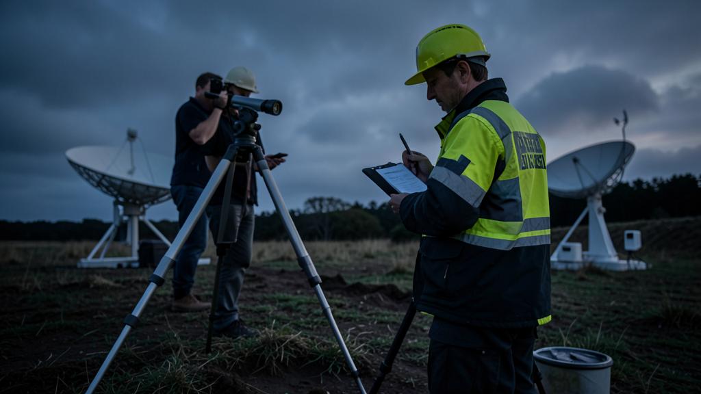
The most common confusion thrives at this point: resolution is not accuracy. Runway points are published to sub-metric resolutions, and a mistargeted coordinate is published with the same decimal elegance as a good one. States where certain coordinates are not tied to the world reference system declare it in the general section of their aeronautical information publication, sometimes on the chart itself; that mention should be read before using isolated points, not after noticing an offset.
The true breaking point, however, lies elsewhere: it concerns any data that enters the chain from the side. A holding point created by hand, a platform supplied by a client, an obstacle taken from a construction file, a terrain database whose provenance differs from that of the navigation database. These sources are frequently of excellent metrological quality, and just as frequently silent about their frame.
The trap. A point entered manually from a non-aeronautical source — a topographic plan, a surveyor’s certificate, coordinates passed on by the operator of a site — has all the appearance of solid data: it is given to the metre, or better. If it comes from another reference frame, the error it introduces is a bias of several dozen to several hundred metres, constant, reproducible from one flight to the next, and invisible to every onboard integrity monitor, since nothing is malfunctioning. The computer has no way of knowing in which frame the number was counted: it has received only the number.
The type of operation strongly shifts this risk. Scheduled public transport flies almost exclusively to aerodromes whose coordinates have travelled through the official chain, and a hand-entered point remains the exception there. Operations that build their own destinations are in the opposite situation: winching and servicing offshore installations, aerial work, medical rescue to sites recognised case by case, flights departing from private platforms. There, the coordinate is supplied by the client or the site owner, no aeronautical information service steps in to reject a survey lacking a reference frame, and the same data often serves for several years. These operations therefore need a written procedure for receiving coordinates — who requests them, in what form, who rejects them — where a scheduled carrier can get by with checking its user-entered points.
What the crew can see, and how to settle it
A datum shift has a signature. The offset is constant in direction and magnitude over the area concerned, it recurs identically from one flight to the next, it varies neither with the constellation received, nor with the time, nor with the receiver’s operating mode, and it triggers no alert. On a map display, it reads as a slight overall misalignment: the runway symbol and the terrain image that do not quite coincide, the procedure track that always passes on the same side of the physical centreline. A signal anomaly does the opposite: it varies, it degrades the position quality indicators, and monitoring exists precisely to report it.
Hence the course of action. A satellite position doubt is not settled with a second satellite reading: both share the frame, and hence the bias. A useful cross-check goes through an independent ground-based reference — alignment with an instrument landing system localiser, distance to a distance-measuring station, bearing, radar guidance, or simply the runway through the window. And the observed offset must be reported: a datum bias is not a crew incident, it is a data defect. It gets corrected upstream, for everyone, or it will come back on the next flight.
The right reflex. Treat a coordinate without a stated reference frame as unusable data, whatever precision it displays. Before entering or integrating a point that does not come from the navigation database, demand three items in addition to the numbers: the geodetic reference system, its realisation epoch, and the surface from which heights are counted. If any one of the three is missing, the answer is not to round or to estimate, it is to send the request back to whoever issued it.
What is still worth checking at home
Three checks can be made without delay. First, the general section of the aeronautical information publication of the States where operations take place: it states the reference system used, the accuracy of the published coordinates and, where applicable, which points are not tied to it. Next, the operations manual: who creates a user-entered point, from which sources, with what traceability — the most frequent entry point for mistargeted data, and the easiest to close. Finally, the consistency between onboard datasets: navigation database, terrain database and obstacle database do not share provenance or update cycle, and a clearance margin calculated between two different frames is a fictitious margin.
Two grey areas remain. The first is vertical: the height reference is declared less systematically than the position reference, even though it carries the geometric vertical guidance. The second is temporal: long-lived data — isolated sites, offshore platforms, seldom-used aerodromes — may have been tied to an old realisation, and drift adds to it without anything changing in how the figure is presented.
For anyone preparing a qualification or a technical interview, the expected answer is simple to state: knowing how to say in which frame a satellite receiver computes, in which frame the database is supposed to be expressed, what a disagreement between the two produces, and why integrity monitoring will not see it. This is the reading grid common to every building block of performance-based navigation, whether in a technical training course or in preparation material. The answer « the survey was to the centimetre » answers none of these four questions.
This article describes a mechanism and does not replace any binding document. The applicable regulations, the aeronautical information publications of the States concerned, and the operator’s approved documentation take precedence over what is written here: that documentation prevails in the event of a discrepancy.
Questions fréquentes
Why not publish coordinates in the national reference system, which is more accurate locally?
Because local accuracy is of no use in a subtraction between two different frames. The receiver computes its position within the frame of the satellite orbits broadcast to it; if the target point is expressed in another frame, the guidance error contains the entire offset between the two, whatever the quality of the survey. The world reference system was not chosen because it describes each territory better, but because it is the only one common to the satellites, to the States and to the onboard databases.
What order of magnitude can an offset between two reference systems reach?
From a few dozen metres in the most favourable cases to several hundred metres, with the largest values concerning old networks tied to a distant origin point, particularly in island areas. This offset cannot be guessed from the figures: it is read from the transformation parameters published for the area. By comparison, the lateral containment value of a performance-based approach is counted in fractions of a nautical mile, which makes such a bias immediately significant.
Can the receiver's integrity monitoring detect a coordinate expressed in the wrong reference frame?
No. Monitoring functions, whether receiver autonomous or provided by satellite-based augmentation, test the consistency of the measurements and the health of the signal. A mistargeted coordinate introduces no inconsistency: the receiver correctly estimates its position and correctly aims at the point it has been given. The error lies in the data, not in the signal, and it therefore remains entirely silent.
How can a datum bias be distinguished in flight from a satellite position anomaly?
By the behaviour of the offset. A datum bias is constant in magnitude and direction over the area, recurs identically from one flight to the next, varies neither with the constellation received nor with the time, and triggers no alert. A signal anomaly varies, degrades the position quality indicators and triggers an alert. The cross-check must be made with a ground-based reference, never with a second satellite reading that would share the same frame.
What must be required with coordinates supplied by a third party before using them?
Three items in addition to the numbers: the geodetic reference system, its realisation epoch, and the surface from which heights are counted, along with any geoid model applied. A stated centimetric uncertainty without these three items tells you nothing usable for navigation. If any one is missing, the data is sent back to whoever issued it rather than being added to a database or entered as a user point.
Does the vertical part of a reference system have operational consequences?
Yes, and it is the least often declared. Heights may be counted above the ellipsoid or above a surface close to mean sea level, and the gap between these two surfaces typically runs to several dozen metres, in one direction or the other depending on the region. The final segment of a satellite-based vertically guided approach is described geometrically relative to the ellipsoid, while published altitudes read on the altimeter are tied to a barometric reference set to mean sea level: a survey silent on its vertical reference and on the geoid model used cannot feed that part of the procedure.


Leave a Reply
You must be logged in to post a comment.