
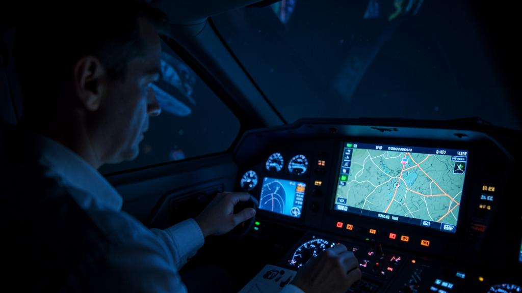
A navigation deviation is almost never one failure. It is the sum of three independent contributions, only one of which is displayed on the flight deck, and the one crews reach for first — the flight management computer — is usually the smallest of the three. Total system error is the accounting framework that keeps the conversation honest: it says where an error came from, who owns it, and which indication would have shown it before anyone noticed the aircraft was in the wrong place.
Three errors that add up to one deviation
Performance-based navigation does not ask an aircraft to be perfectly positioned. It asks that the difference between where the aircraft actually is and where it was supposed to be stays inside a stated figure for a stated proportion of the flying time. That difference is the total system error, and the whole architecture of PBN rests on splitting it into three terms that are produced by three different parts of the operation.
Path definition error is the gap between the path the procedure designer intended and the path actually defined inside the navigation database. Nobody flies it wrong; it is wrong before anyone touches it.
Navigation system error is the gap between where the aircraft really is and where the navigation system believes it is. It is a sensor and estimation problem, invisible by construction.
Flight technical error is the gap between the defined path and the position the navigation system computes for the aircraft — in other words, how well the aeroplane is being flown or steered along the path it was given.
The three are conventionally combined as a root sum of squares, on the assumption that they are independent and centred on zero. That assumption is doing a lot of work, and it is the first thing to question when a deviation does not behave like noise. A stuck bias, a systematic database offset or a crew technique that always overshoots the same way is not a zero-mean random term, and the budget stops describing reality.
| Contribution | What it measures | Who owns it | What would reveal it |
|---|---|---|---|
| Path definition error | Coded path versus intended procedure | Procedure designer, data supplier, database packer | Chart-to-display comparison before the leg is flown |
| Navigation system error | Estimated position versus true position | Sensors, positioning mode, signal environment | Performance indication, integrity alerting, independent cross-check |
| Flight technical error | Estimated position versus defined path | Autopilot, flight director, crew technique | Cross-track and vertical deviation displays |
Total system error is like a budget for how far off track an aircraft can be. It’s made up of three parts: mistakes in the path design, errors in the navigation system’s position estimate, and how well the crew is flying the plane. If any of these parts is off, the plane might not be where it should be, even if the instruments say it is.
On a cold day, an Airbus A320 flying an RNP approach with barometric vertical guidance might show a perfect lateral deviation but be slightly low on the vertical path, because cold air makes the barometric altitude read high. The navigation system (second term) and the crew’s steering (third term) are fine: the error sits in the path definition (first term), which is why these approaches have temperature limits.
The needle only shows one of the three
This is the most consequential fact of the subject, and it is rarely stated plainly. The cross-track deviation shown on the navigation display is computed between the estimated position and the defined path. Both terms come from inside the same system. The display is therefore an exact measure of flight technical error, and it is structurally blind to the other two.
Consequently, a perfect zero cross-track proves only that the aeroplane is where the box thinks it should be. If the position estimate has drifted, the display stays clean while the aircraft leaves protected airspace. If the leg was coded to the wrong waypoint, the display stays clean while the aircraft flies precisely along a path nobody designed. The reassurance offered by a centred needle is real, but narrow.
The trap. Treating a clean lateral deviation as proof of navigation accuracy. It proves steering accuracy against an internal reference. The two questions a clean needle cannot answer are: is the estimated position right, and is the coded path right?
Path definition error: the term that ought to be zero
In most analyses this contribution is assumed negligible, and for good reason: the entire data chain from survey to procedure design to ARINC 424 coding to the packed database exists to make it so. Coordinates are referenced to WGS-84, leg types are standardised, and quality assurance is applied at each handover. When the chain works, the coded path and the designed path are the same path.
When it fails, it fails silently and identically on every flight until someone notices. Recurring sources are worth knowing by name:
- A survey or datum problem upstream, where the published coordinates do not sit where the physical feature sits.
- Magnetic variation. Charts and procedures are largely magnetic, the aircraft computes in true and applies a stored variation model, and the model has an epoch. High-latitude and true-north-referenced procedures make this visible.
- Leg-type coding: a fly-by turn coded as fly-over, or the reverse, produces a path that differs from the drawing at exactly the point where the terrain margin was tightest.
- Truncated coordinate resolution, or a waypoint with the same name used in more than one place.
- Operator or manufacturer tailoring applied on top of the supplier data, which reintroduces a manual step into an otherwise controlled chain.
None of these can be detected in flight by reading the deviation. They are detected by comparing the display with the chart before the leg matters — which is why the pre-approach briefing includes a look at the tracks and distances, and why a mismatch between chart and display is a stop item rather than a curiosity.
Navigation system error: what the box knows about its own doubt
The positioning term is the only one the aircraft attempts to quantify for itself. Depending on the manufacturer it is displayed as actual navigation performance or estimated position uncertainty, and it is not a measurement of error — it is a bound. The system is stating the radius inside which it is confident the true position lies, given the sensors currently contributing.

That bound moves for reasons that have nothing to do with how the aircraft is flown:
- Satellite navigation available and augmented. With a satellite-based augmentation service, or with airborne integrity monitoring and good geometry, the bound is small and stable.
- Satellite navigation degraded. Poor geometry, masking, interference or deliberate jamming reduces the available integrity margin. Jamming and spoofing near conflict areas have made this an operational planning item rather than a theoretical one, and the guidance published by ICAO and by national authorities now treats loss of satellite positioning as a foreseeable condition.
- Radio updating. Distance-measuring equipment pairs give a good position when two facilities are well placed relative to the aircraft, and a poor one when the geometry is shallow or the coverage is thin. Position quality then depends on where you are, not on the equipment standard.
- Inertial coasting. With no external update the error grows with elapsed time. This is the classic oceanic case, and the only one where the positioning term reliably becomes the dominant contribution.
A crew that treats the performance indication as scenery misses the only instrument that speaks to this contribution. A crew that watches it sees the reversion coming — the bound creeping outward — before the alert, which is precisely when there is still time to plan.
The right habit. Read the performance bound and the required figure as a pair, in the same glance, at the same points in the flight where you would check fuel. A number that is small but growing tells you more than a number that is merely inside limits.
Flight technical error: the biggest term in most real deviations
Once the database is correct and satellite positioning is available, the arithmetic is simple: the steering term dominates. It is also the term with the widest spread, because it depends on what is doing the steering.
Coupled, flight director, raw data
Autopilot-coupled lateral navigation produces the smallest and most repeatable steering error. Manual flight with a flight director is worse and more variable between individuals. Manual flight with raw guidance is worse again. Certification and procedure design material carries assumed values for each of these cases, and the values are not interchangeable — which is why an operational approval can be tied to a flight technique. Changing the technique changes the budget without anyone rewriting a number.
Where the steering error actually lives
It is not evenly distributed along the route. It concentrates at transitions: fly-by turns taken with a strong tailwind component, radius-to-fix legs where the bank required is at the limit of what the autopilot will command, level changes coinciding with a track change, and the first seconds after a mode change. Any deviation study that samples once a minute on straight legs will conclude that steering error is negligible, and will be wrong about the only moments that matter.
The failure that is not in the budget at all
Gross errors — the wrong waypoint inserted, a leg sequenced early, a discontinuity closed the fast way, a heading mode left engaged after a vector — are not a contribution to total system error. They are outside the statistical model entirely. The budget describes how well a correct intention is executed; it says nothing about a wrong intention executed perfectly. Cross-checking the active leg against the clearance is a defence against a category of event that the accuracy figures do not cover.
Which term dominates, phase by phase
The practical value of the decomposition is that it predicts where to look. The dominant term shifts with the phase, the airspace and the guidance in use, and it shifts foreseeably.
| Situation | Typical positioning source | Dominant term | Why |
|---|---|---|---|
| Oceanic or remote, coupled, satellite positioning available | Satellite | All three small; risk is gross error | Long legs, few transitions, no external check for hours |
| Oceanic after loss of satellite positioning | Inertial coasting | Navigation system error | Error grows with elapsed time since last update |
| Continental en-route on radio updating | Distance-measuring pairs | Navigation system error, variable | Position quality follows facility geometry and coverage |
| Terminal arrival, coupled, curved and fly-by transitions | Satellite | Flight technical error | Turn anticipation, wind, bank limits, mode changes |
| Terminal area flown in heading mode after vectors | Satellite | Outside the budget | No defined path is being followed, so the accuracy figures no longer describe the situation |
| Final approach segment, coupled, correct database | Satellite, augmented where available | Flight technical error, small | Positioning bound far below the requirement |
| Final approach segment with a coding or variation problem | Any | Path definition error | Systematic, repeatable, invisible on the deviation display |
Monitoring and alerting answers one question, not three
The feature that separates a navigation specification requiring on-board performance monitoring and alerting from one that does not is exactly this: the system is required to tell the crew when it can no longer support the accuracy demanded. That alert is about the positioning term. It is not a steering alert, and it is not a database alert.
The requirement is expressed in two parts. The total system error must remain within the stated figure for at least ninety-five per cent of the flight time, and the probability of exceeding twice that figure without annunciation must remain below an agreed threshold. That threshold is fixed by the applicable navigation specification rather than being one universal figure, and the specifications written for operations subject to a specific authorisation sit at the demanding end of the range. What matters operationally is the shape of the promise: the system will warn you about its own positioning, and about nothing else.
So the responsibilities divide cleanly. The equipment monitors the positioning term. The crew monitors the steering term, using the deviation display. Nobody monitors the coded path in flight — which is why it has to be checked on the ground and briefed before it is flown.
The trap. Waiting for an alert before treating navigation performance as a problem. The alert is the last line of a chain that starts with a bound that has been creeping outward for some time. By then the options are fewer and the workload is higher.
The vertical budget is a different animal
Barometric vertical navigation does not decompose the same way, and importing the lateral vocabulary produces confusion. The vertical path is derived from barometric altitude, so the error budget includes the altimetry system error of the airframe, the setting and the accuracy of the reported pressure, and — the term with real teeth — the deviation of the actual atmosphere from the standard temperature profile.
The physics is unforgiving: in air colder than standard, true altitude is lower than indicated, so a barometrically derived descent path sits below the designed path. This is why temperature limits are published on procedures and why cold-temperature corrections to published altitudes are part of the procedure and not an optional refinement. Satellite positioning does not fix it, because the vertical guidance was never derived from satellites in the first place. Only augmentation-based vertical guidance, where available and approved, removes the temperature dependency from the path itself.
Diagnosing a deviation without guessing
When something does not look right, the decomposition converts an argument into a short sequence of checks. Each symptom points at a different contribution.
| What you observe | Most likely contribution | What discriminates it |
|---|---|---|
| Deviation display centred, but a controller or an independent source reports an offset | Positioning or coded path | Independent position reference; performance bound; chart comparison |
| Deviation builds only in turns and washes out on the straight | Steering | Wind and groundspeed at the transition; bank limit; mode in use |
| Small constant offset held all along a straight leg | Steering bias or coded path | Compare charted track with displayed track; check variation reference |
| Performance bound growing with nothing changing on the display | Positioning | Sensor status page; positioning mode; satellite availability and interference reports |
| Aircraft sequences a waypoint nobody expected | Neither — gross error or database content | Read the active leg against the clearance and the chart |
| Vertical path low on a cold day, lateral perfect | Temperature, not navigation | Aerodrome temperature against the published limit; correction applied? |
What this changes in daily operation
Three conclusions survive contact with the line. First, the flight management computer is rarely the culprit; it is the display surface on which other people’s errors and your own steering appear. Second, the deviation you can see is the contribution you already control, and the two you cannot see require different defences — a briefing for the coded path, an instrument reading for the positioning. Third, the moment to act on a positioning problem is while the bound is still inside limits, because the alert marks the end of the useful decision window rather than its beginning.
Operators that debrief navigation events with this vocabulary learn something. A report that records « FMS error » teaches nothing, because it blames a box and describes no mechanism. Recurring coding oddities and regional satellite interference are both discussed on the FL330 professional forums, and the useful reports are the ones that name which of the three terms moved.


Leave a Reply
You must be logged in to post a comment.