
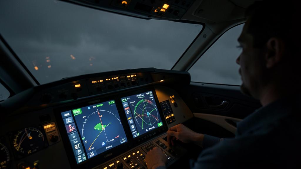
The message arrives in cruise, over airspace without distance-measuring stations: loss of the satellite’s primary function, followed by downgrade of navigation accuracy. The aircraft has not deviated an inch, the track stays centred on the display, and the capability declared in the flight plan has nonetheless just changed. What happens between these two messages is not an instrument failure: the displayed position stops being a monitored measurement and becomes an estimate that ages.
What the satellite feeds beyond position
A Global Navigation Satellite System receiver supplies three quantities — position, velocity, time — consumed by systems that have no obvious reason to depend on it. The inventory of consumers gives the real measure of the failure:
- the flight management computer’s hybrid position;
- integrity monitoring by receiver autonomous integrity monitoring, the only function able to announce that the computed position no longer supports the required performance;
- the position transmitted in automatic dependent surveillance, with the quality indicators the ground uses to select its separation;
- the ground proximity warning system’s interrogation of the terrain database, which produces false alerts on a false position;
- the time reference for several items of equipment, the wind calculation (hence the fuel prediction), and satellite-based vertical guidance.
A corollary rarely stated: the classic instrument landing system remains, in practice, the precision approach means one falls back on when the constellation is unavailable. Satellite-based vertical guidance, including ground-augmented, depends on it by construction; other independent means exist but remain too little deployed to constitute a realistic backup plan on a given network.
When GNSS fails, the aircraft doesn’t just lose precise positioning. It also loses time synchronization, wind calculations, and even some safety alerts. The system tries to keep flying, but with less accuracy and no way to warn you when it’s wrong.
An Airbus A320 flying over the Atlantic at FL370 loses GNSS. The FMS switches to inertial navigation, but after 2 hours, the position error grows to 5 NM. The crew only notices when ATC reports a 10 NM discrepancy from radar tracking.
The fallback hierarchy: what the computer actually does
There is no switch, in a modern computer, that would flip from one source to another. There is a hybrid position, maintained by a filter that blends the inertial solution with radio measurements, each source weighted according to the quality the system assigns it. Losing the satellite therefore cuts nothing: it redistributes the weights. Hence a silent transition, on an unchanged display.
The order of preference is roughly universal, only the terminology varying between manufacturers: satellite, then two distance-measuring stations, then bearing associated with a distance, then inertia alone.
Updating by two distance measurements
Two measured distances give two circles, hence two intersections of which one is discarded by the estimated position. The solution is excellent in horizontal accuracy, but conditional: it requires two stations present in the database, within line of sight, outside the uncertainty cone, and in an exploitable geometry, infrastructure criteria typically excluding crossing angles that are both too narrow and too wide, the useful range being on the order of thirty to one hundred fifty degrees. Outside that range, the intersection becomes grazing and the position error amplifies for the same measurement error. This is the terrestrial counterpart of geometric dilution of precision, and it is vicious because it gives no warning: the source remains available when its contribution is no longer worth anything.
A second point, often lost sight of at high cruise: above an ocean or a sparsely equipped airspace, geometry is not the issue — there is simply no station. This fallback is continental; it disappears exactly where the satellite was most useful.
The single-station case
A single station gives a bearing and a distance, hence a point. But since the bearing error is angular, the lateral error grows with range: this source does not age over time, it degrades over distance.
| Source | Dominant error | Evolution law | Onboard monitoring |
|---|---|---|---|
| Satellite with onboard augmentation | Constellation geometry, propagation | Bounded, no memory of flight time | Yes, through measurement redundancy |
| Two distance stations | Crossing angle, ranging | Function of instantaneous geometry | No; consistency between sources |
| Bearing and distance | Angular bearing error | Grows with distance to the station | No |
| Inertia alone | Sensor drift, initial alignment | Grows with time since last update | No; the spread between platforms is informative |
Why inertia ages, and according to what law
An inertial platform has no external reference. It integrates accelerations to obtain a velocity, then integrates that velocity to obtain a position: any measurement error is integrated twice, and the initial alignment error behaves as a permanent bias.
The error does not, however, grow monotonically. The loop that keeps the platform level with respect to the local vertical introduces an oscillation whose period is that of the Schuler pendulum, on the order of eighty minutes. The radial error is a growing envelope on which this oscillation is superimposed: over a stretch of a few tens of minutes, it can appear to decrease. That is not a sign of good health, it is a phase.
Two points matter operationally. The order of magnitude first: historical certification criteria for inertial platforms express the requirement as a radial error on the order of a few nautical miles per hour of un-updated flight — a statistical value, with an associated confidence level, not a guaranteed bound. The only value that is binding for a given type is the one in its documentation. The starting point of the count next: the clock starts at the last valid update, not at takeoff.
One last observable, free and underused: when several inertial platforms are installed, each drifts at its own rate. The spread between their positions, displayable on most types, measures the drift under way and signals it before any downgrade message.
The symmetrical case deserves stating, because it concerns entire fleets: on a type with no inertial reference — regional turboprops, light twins, aircraft whose computer receives only air data and heading — there is no fourth source. Outside distance-station coverage, losing the satellite reduces the computer to dead reckoning maintained by airspeed and heading: the error no longer obeys a sensor-drift law but a wind-estimate law, it grows faster and without the regular oscillation that makes inertia predictable. The same alert message therefore does not cover the same time margin depending on what the type carries.
The right reflex. From the first loss message, note the time and position of the last valid update, then keep that elapsed time current. Estimated accuracy, declared capability, diversion: everything is counted from that instant, and it is the one piece of data the system will not remind you of.
From accuracy to integrity: what the declared capability loses
This is where reasoning most often goes astray. A navigation specification is not an accuracy threshold: it is a set comprising accuracy, integrity, continuity, onboard functions, ground infrastructure, and crew qualification. The criterion that separates required navigation performance specifications from area navigation specifications is the presence, on board, of performance monitoring paired with an alert.

The cheapest demonstration of this principle is a renaming. The specification once called ten-mile required navigation performance was renamed ten-mile area navigation without a single figure changing, on the grounds that it lacks onboard monitoring paired with an alert. The difference is not about performance, but about the system’s ability to announce that it no longer holds it.
A consequence follows that instantaneous accuracy cannot contradict: certain specifications are unreachable without a satellite, whatever the momentary quality of the position.
| Specification family | Supporting sensor | Onboard monitoring | Status after loss |
|---|---|---|---|
| Required navigation performance approach and authorised variants | Satellite mandatory | Required | Lost |
| Tightened en-route specifications | Satellite mandatory | Required | Lost |
| Terminal-area area navigation | Satellite, or two stations with inertial support | Not required | Retained if infrastructure exists |
| Continental en-route area navigation | Satellite, two stations, bearing and distance, or time-limited inertia | Not required | Generally retained |
| Wide oceanic area navigation | Inertia, within the time limit since last update | Not required | Retained within the approved limit |
What remains is the displayed figure. With the satellite, estimated accuracy relies on measurement redundancy: the receiver compares solutions derived from different subsets of satellites and infers a bound from them. Without the satellite, that bound becomes a model extrapolation, fed by elapsed time and assumed drift parameters. The figures look alike, their status differs: the first is measured, the second predicted. When the predicted value exceeds the value required by the route, the computer announces that it no longer holds the specification because a model has crossed a threshold, not because an error has been observed.
The trap. The displayed cross-track error is calculated relative to the position the computer believes it occupies. If that position drifts, the error stays at zero and the track stays centred on the display while the aircraft moves away from its intended path. Inertial drift is invisible, by construction, on the very instrument used to monitor it. Only an independent source reveals it: a raw radio bearing, a position given by air traffic control, the spread between two inertial platforms.
What the lost capability changes in the airspace crossed
Loss of capability is not paid for in accuracy, it is paid for in available airspace. In oceanic or remote airspace, separation minima are not backed by navigation alone: they rest on a combined navigation, communication and surveillance package, of which the navigation specification is only one of three pillars. Tighter minima, on the order of a few tens of nautical miles, presuppose the tightened navigation specification and communication and position-reporting performance held from end to end; wider minima can accommodate the wider specification. An aircraft that loses the first does not lose the right to fly; it loses the right to occupy a track dimensioned for the tighter minimum. In a saturated organised track system, the consequence is immediate: a level, a route, or an offset to negotiate.
In continental airspace, the effect shifts toward terminal procedures: satellite-based departures and arrivals, area-navigation holds, required-navigation-performance approaches. The question is not whether one can continue, but what remains available at destination and at the alternates. If only a classic instrument landing system remains, the choice of alternate changes and the associated fuel must be settled before the point of no return, the point beyond which the problem stops being a navigation problem.
Surveillance remains: the position transmitted in automatic dependent surveillance carries its quality indicators, and when they fall, it is the very foundation of the separation applied by air traffic control that gives way.
Two forms of loss that do not call for the same response
Jamming drowns the signal: the receiver loses track, reports it, and the computer redistributes its weights. The degradation is noisy, orderly, and the crew knows where they stand. Spoofing, by contrast, supplies a coherent but false signal: the receiver detects no anomaly, computes an erroneous position or time and propagates it with every appearance of normality. This is the dangerous form, because it contaminates systems that trust the position without questioning it, and unjustified terrain alerts are often the first indication of it.
The second trap. Spoofing that shifts the time reference does not stop at the edge of the affected zone: an aberrant timestamp can be stored by equipment that subsequently rejects valid data, and an inertial platform realigned on a spoofed position retains that error until a realignment on the ground. Realigning to start clean is the one thing not to do inside the affected zone.
The reflex that avoids it. When the satellite position becomes intermittent or is obviously false, deliberately deselecting the sensor, where the type permits it, is preferable to an unwitting blend: the computer falls back on a source whose degradation law is known, and estimated accuracy again becomes readable.
What to check in your own documentation
The principles above apply across all types; their implementation does not. Five checks are worth making cold rather than discovering in cruise:
- is deselecting the satellite sensor a crew action on your type, and does it leave automatic dependent surveillance transmitting a degraded position or nothing at all;
- is estimated accuracy displayable in plain figures, or only as a message: the answer determines whether one anticipates the loss of capability or merely observes it;
- what duration of un-updated inertia the operational approval allows, and from which event it is counted;
- the realignment policy after suspected spoofing, and the associated maintenance report;
- the distance-measuring infrastructure actually usable on your habitual routes, since a fallback with no station in view exists only on paper.
One asymmetry deserves exploiting: a good part of these losses can be anticipated. Aeronautical information publications report known trials and interference zones, and integrity-monitoring availability prediction tools allow one to assess before departure whether it will hold at the intended time and place. An anticipated degradation is handled in preparation — route selection, an alternate equipped with an independent approach means, corresponding fuel. The same degradation discovered in cruise is handled under the constraint of available level and time, that is, at the worst possible moment.
A grey zone remains that nobody has closed: the boundary between a degradation one manages and an event one reports. A few minutes of loss over a region known to be jammed does not feel like an anomaly; it remains, nonetheless, a piece of information whose value depends on it being reported. An interference report turns an individual nuisance into an exploitable map.
For anyone preparing a type rating or a technical interview, the subject has become discriminating. What is expected is no longer a recitation of specifications, but the ability to say which sensor supports which, what the computer does with its loss, and at what instant the decision shifts from navigation to fuel. The technical preparation courses that approach performance-based navigation through the underlying mechanism stand out on this very question.
The aircraft flight manual, the operations manual and the operator’s performance-based navigation approval prevail over any general account, this one included. In case of discrepancy between what is written here and your approved documentation, your documentation governs.
Questions fréquentes
Why does the track stay centred on the display while the position drifts?
Because the cross-track deviation is calculated relative to the position the computer estimates it occupies, not relative to a true position. If that estimate drifts, the aircraft faithfully follows a false track with a displayed deviation of zero. Only an independent reference makes the actual deviation observable: a raw radio bearing, a position transmitted by air traffic control, or the divergence between two inertial platforms.
Is updating by two distance-measuring stations as good as the satellite?
In horizontal accuracy it comes close, but it is far more conditional. It requires two stations present in the database, within line of sight, outside the uncertainty cone, and in an exploitable crossing geometry, beyond which the error amplifies without the source ceasing to be reported available. Above all, it does not exist over oceanic areas or sparsely equipped airspace — precisely where the need is greatest.
Can a tightened en-route specification be maintained with inertia alone?
No, and it is not a question of accuracy. Required navigation performance specifications demand onboard performance monitoring paired with an alert, a function inertia does not provide. The capability is therefore lost by nature, even if the position remains momentarily excellent. Inertia only supports area navigation specifications, and the wide oceanic specification only within an approved time limit.
Is the estimated accuracy displayed by the computer a measurement?
It is, as long as the satellite feeds the system, because it then rests on the redundancy of satellite measurements. As soon as that source disappears, it becomes a model extrapolation based on elapsed time and assumed drift parameters. The figure keeps the same appearance but not the same status, and the downgrade message reflects a calculated threshold crossing, not an observed error.
Should inertial platforms be realigned after a suspected spoofing event?
Not inside the affected zone, because realigning on a falsified position or time freezes the error into the very reference one was trying to preserve. The correct response is to freeze the situation, log the observed symptoms, and handle the realignment on the ground on a known position. The exact procedure, including the associated maintenance action, depends on the type and is set out in the operator’s documentation.
What does losing the satellite change for air traffic control and surveillance?
The position transmitted in automatic dependent surveillance carries quality indicators that fall together with the source. The controller therefore loses not only accuracy but the very foundation of the separation being applied, which may require wider separation or a return to procedural methods. Announcing the degraded capability is for this reason as much a surveillance matter as a navigation one.


Leave a Reply
You must be logged in to post a comment.